


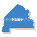
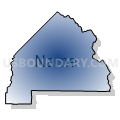
Voting District 54530, Fresno County, California
About
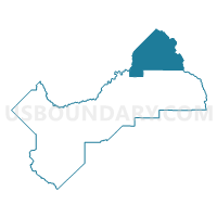
Outline

Summary
| Unique Area Identifier | 530720 |
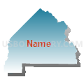
| Name | Voting District 54530 |
| County | Fresno County |
| State | California |
| Area (square miles) | 797.56 |
| Land Area (square miles) | 779.42 |
| Water Area (square miles) | 18.15 |
| % of Land Area | 97.72 |
| % of Water Area | 2.28 |
| Latitude of the Internal Point | 37.32134990 |
| Longtitude of the Internal Point | -119.02207160 |
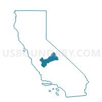
Maps

Graphs
Select a template below for downloading or customizing gragh for Voting District 54530, Fresno County, California


Neighbors
Neighoring Voting District (by Name) Neighboring Voting District on the Map
- Voting District 10000, Inyo County, CA
- Voting District 10015, Inyo County, CA
- Voting District 20010, Mono County, CA
- Voting District 50001, Mono County, CA
- Voting District 50480, Madera County, CA
- Voting District 54510, Fresno County, CA
- Voting District 54511, Fresno County, CA
- Voting District 54545, Fresno County, CA
Top 10 Neighboring County Subdivision (by Population) Neighboring County Subdivision on the Map
- Sierra CCD, Fresno County, CA (18,981)
- Oakhurst-North Fork CCD, Madera County, CA (13,969)
- Bishop CCD, Inyo County, CA (12,600)
- Mammoth Lakes CCD, Mono County, CA (12,117)
Top 10 Neighboring Place (by Population) Neighboring Place on the Map
Top 10 Neighboring Elementary School District (by Population) Neighboring Elementary School District on the Map
- Bishop Union Elementary School District, CA (11,908)
- Round Valley Joint Elementary School District, CA (1,068)
- Pine Ridge Elementary School District, CA (855)
- Big Creek Elementary School District, CA (444)
Top 10 Neighboring Secondary School District (by Population) Neighboring Secondary School District on the Map
Top 10 Neighboring Unified School District (by Population) Neighboring Unified School District on the Map
- Sierra Unified School District, CA (9,980)
- Mammoth Unified School District, CA (9,601)
- Chawanakee Unified School District, CA (4,684)
- School District Not Defined, CA (710)
Top 10 Neighboring State Legislative District Lower Chamber (by Population) Neighboring State Legislative District Lower Chamber on the Map
- Assembly District 29, CA (510,976)
- Assembly District 34, CA (487,193)
- Assembly District 25, CA (475,252)
Top 10 Neighboring State Legislative District Upper Chamber (by Population) Neighboring State Legislative District Upper Chamber on the Map
- State Senate District 18, CA (1,048,811)
- State Senate District 14, CA (1,020,927)
- State Senate District 1, CA (1,002,597)
Top 10 Neighboring 111th Congressional District (by Population) Neighboring 111th Congressional District on the Map
- Congressional District 25, CA (844,320)
- Congressional District 21, CA (784,176)
- Congressional District 19, CA (757,337)
Top 10 Neighboring Census Tract (by Population) Neighboring Census Tract on the Map
- Census Tract 2, Mono County, CA (8,237)
- Census Tract 1.02, Madera County, CA (4,163)
- Census Tract 1.01, Mono County, CA (3,463)
- Census Tract 64.02, Fresno County, CA (2,973)
- Census Tract 2, Inyo County, CA (1,718)
Top 10 Neighboring 5-Digit ZIP Code Tabulation Area (by Population) Neighboring 5-Digit ZIP Code Tabulation Area on the Map
- 93514, CA (13,857)
- 93546, CA (9,567)
- 93602, CA (3,862)
- 93643, CA (3,171)
- 93604, CA (674)
- 93664, CA (585)
- 93605, CA (175)
- 93634, CA (33)